

Black Canyon of the Gunnison National Park in Colorado was designated as a National Monument in 1933 and achieved National Park status in 1999. Its name reflects the deep shadows that often cloak its depths, with some areas receiving as little as 33 minutes of sunlight each day. Formed by the Gunnison River over two million years, the canyon reaches a staggering depth of 2,722 feet and narrows to just 40 feet at its riverbed. This dramatic landscape is home to the world’s fastest bird, the Peregrine falcon, along with red-tailed hawks, golden eagles, white-throated swifts and mammals like mule deer, black bears, and various small mammals. The Ute Tribe refers to the Gunnison River as “Much Rock, Big River.” Visitors should be aware that exploring this rugged terrain comes with risks. For those seeking stunning natural scenery and fewer crowds, Black Canyon National Park is a must-visit destination.
Traveling
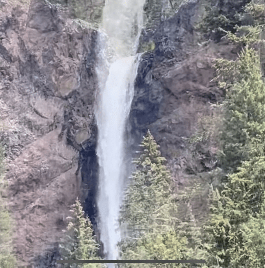
After leaving Sand Dunes National Park we traveled across Highway 160 and discovered Treasure falls along a beautiful scenic route.
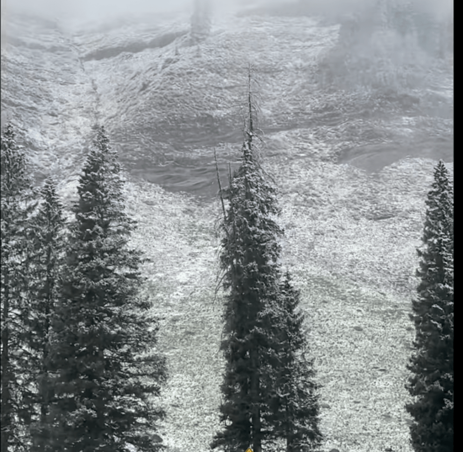
Then we traveled across Coal Bank Summit Pass. Here we found the ground covered in snow with flakes still falling.
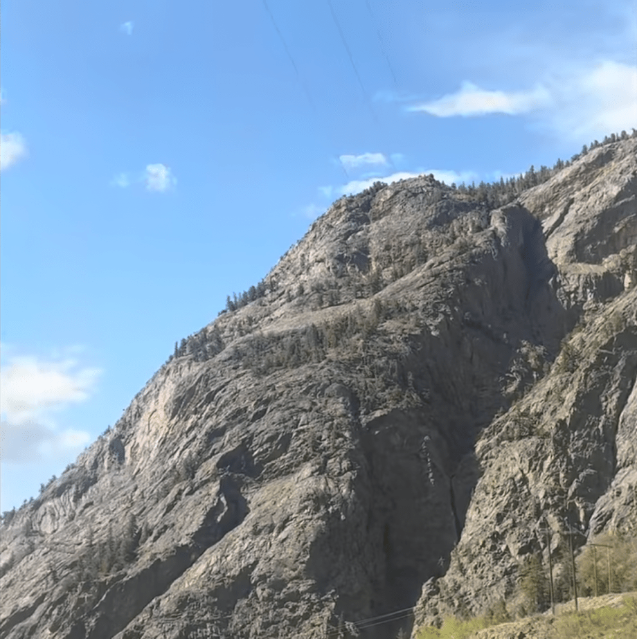
Last we made it to the Million Dollar Highway making our way to Montrose, the entrance to the South Rim of the Black Canyon of the Gunnison National Park. We had to adjust our driving skills at this point with the camper on the back of the truck. The brakes did not like the drive up and down three mountains on the same day. We started using lower gears instead of our brakes because the breaks were hot.
Black Canyon of the Gunnison
We finally made it to the Black Canyon of the Gunnison in Colorado. This was such a beautiful park to explore. We did not hike to the bottom of the canyon but we experienced many of the overlooks from the top.

This guide highlights essential activities and sights to experience in the park, with all stops conveniently located on the right side of the road as you navigate through. The list is organized based on our travel route, and I’ve also included some recommendations we had to forgo due to time constraints.
- Chasm View
- Painted Rock View (skipped this one but went to Cedar Point View)
- Cedar Point Nature Trail .2 miles (better view of Painted Wall)
- Pulpit Rock
- East Portal Road into canyon (long drive down the canyon and a 4-wheel drive smaller vehicle was needed) If your vehicle does not exceed 22 feet in length and you want to attempt the steep 16% grade road with sharp narrow curves, share your experience with me. Our rig was to long for us to have this experience but take note that it is closed during the winter(Nov.-April).
- Warner Point Trail 1.5 round trip hike (did not hike this trail but it is suggested)
- Sunset View
- Stargaze (I read this is a beautiful park to see the celestial body but due to time we had to continue to our next national park.)
- North Rim is also available and less visited. Travel from the South Rim to the North Rim is approximately 2 hours.
After departing from Black Canyon of the Gunnison, we headed to Arches National Park, making a quick stop in Grand Junction for Jeremy to replenish his snuff supply. To his surprise, his preferred brand was unavailable, and he found Copenhagen priced at an astonishing $12 a can, which seemed outrageous to us.
Upon entering Utah, we took the scenic byway 128, initially doubting our route due to the bumpy, pothole-ridden road that slowed our progress with the camper in tow. Despite being overtaken by faster vehicles, we enjoyed spotting numerous prairie dogs along the way. Eventually, we reached Scenic Byway 128, a stunning road that winds alongside the Colorado River. Driving through the canyon at sunset was a breathtaking experience.
Camping
We set up our primitive campsite at a state park adjacent to the national park, though the experience was somewhat unsettling due to the neighboring camper. The access road to the sites was quite rough, with several sections washed out. Despite these challenges, we would consider returning if we visit the park again, as it was incredibly convenient to wake up just 15 minutes from the park entrance.
Click here to see pictures of the park and the experience of my children.
Maps
I’m sharing a link to assist you in planning your visit to this national park. This resource includes a detailed map of the park, which will be invaluable for your trip.
Hiking Trails
I have provided a link and a QR code for you to discover the various trails available at this national park. The website offers a wealth of information to enhance your exploration experience. The information you will see:
- difficulty level
- distance of hike
- estimated hike time
- rating
- location of trail


Leave a comment