
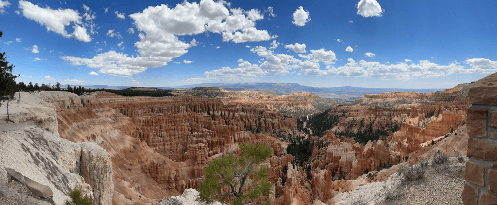
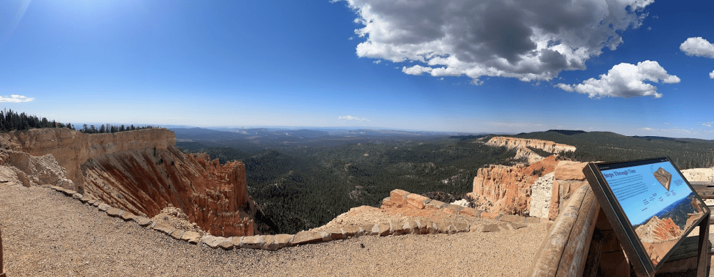
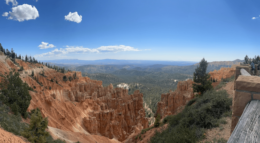
Bryce Canyon, technically not a canyon, features an 18-mile road that stretches from north to south, allowing visitors to easily explore its stunning natural formations. This single main road ensures that you won’t overlook any of the park’s remarkable features. As you reach the top of the Grand Staircase, keep an eye out for the hoodoos—tall, slender rock spires that display a vibrant array of colors and varying thicknesses. The timing of your visit can greatly enhance your experience; during sunrise and sunset, the rocks are bathed in a warm crimson glow, creating a breathtaking spectacle as deep shadows dance across the amphitheater. In this context, “amphitheater” refers to the large, hollowed-out rock formations rather than a venue for concerts. Summer temperatures typically range from 70 to 80 degrees, with afternoon thunderstorms being a common occurrence. While you won’t find any rock bands performing here, the visual wonders of this national park are sure to leave you in awe.
Traveling
On our way in, we passed the Bryce Canyon Mossy Cave Trail, and I regretted not taking the time to hike it. We were focused on finding our next camping spot and decided against any stops that afternoon. After searching, we discovered a primitive campground just outside the park, but it was already full. We turned around and eventually found a campsite that suited our needs on John Valley Road. The next morning, we were awakened by the gentle mooing of cows just outside our window.
The Park
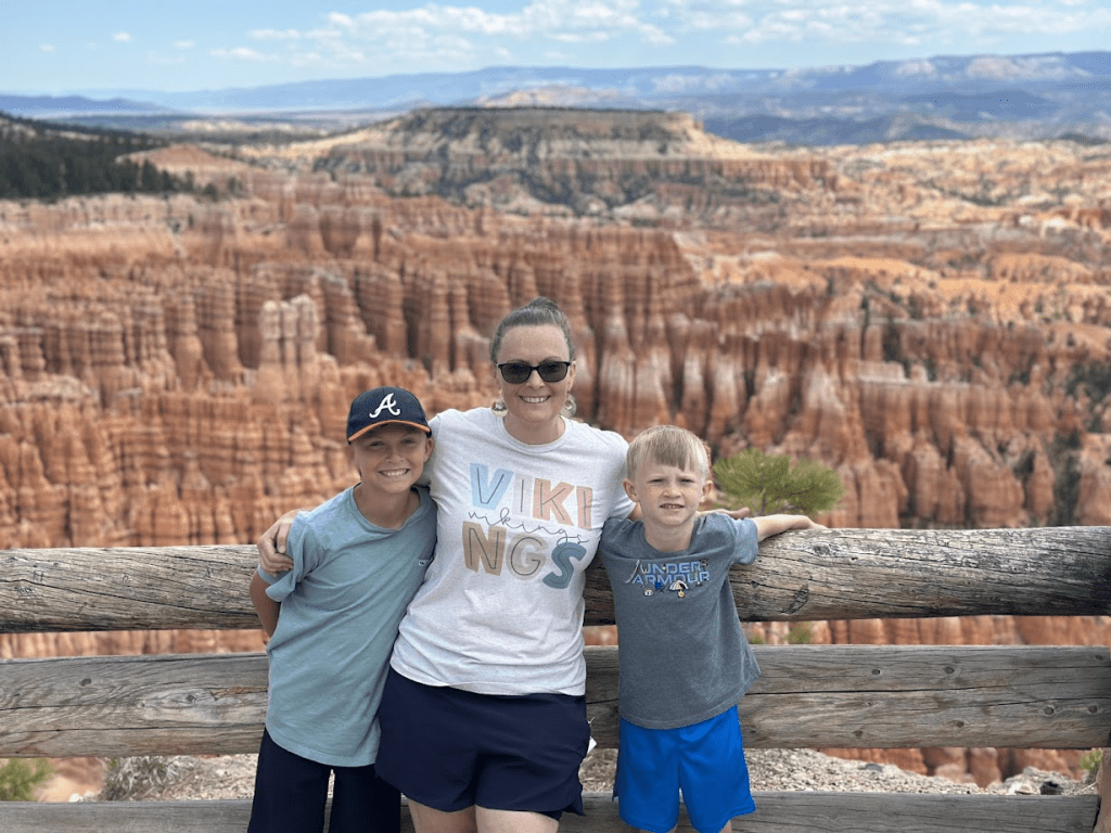
I discovered that this canyon has become my favorite among all the ones I’ve previously written about. The park features numerous overlooks, each offering a unique perspective at every stop, and I was eager to soak in each breathtaking view. On our way in, we accidentally passed the visitor center, mistaking it for a lodge. However, we made sure to stop on our way out so our boys could pick up their junior ranger books to complete. We settled outside to work on these books, excitedly anticipating their pins. We would recommend taking the shuttle at this park. Parking can become a headache.
Viewpoints
Rainbow and Yovimpa Point is located at the most southern point with an elevation of feet above sea level.
Ponderosa Point
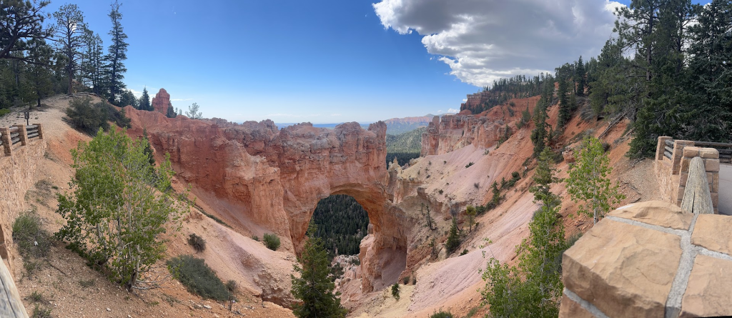
This Natural Bridge could one day erode away.
Swamp Canyon
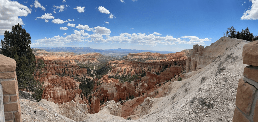
Bryce Amphitheater
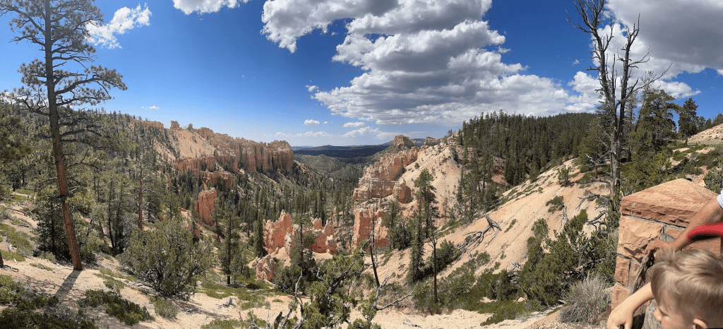
The landscape at this national park has forest lands to sandstones. We recommend driving to the end of Bryce Canyon and stop at the view points on the way back out of the park.
Recommended stops:
- Mossy Cave Trail (.8 mile hike) go before 10 or after 4
- Rainbow Point
- Yovimpa Point
- Bristlecone Loop Trail (1 mile)
- Ponderosa Point
- Swamp Canyon
- Sunrise/Sunset Point
- Inspiration Point
- Bryce Point and Paria View (No RV parking)
- Fairyland Canyon on left before entrance gate or on the right after leaving the park. (drive 1 mile off the main road)
To see our journey through the park. Click here.
Hiking Trails
I have provided a link and a QR code for you to discover the various trails available at this national park. The website offers a wealth of information to enhance your exploration experience. The info includes:
- difficulty level
- distance of hike
- estimated hike time
- rating
- location of trail

Map
I’m sharing a link to assist you in planning your visit to this national park. This resource includes a detailed map of the park, which will be invaluable for your trip.

Leave a comment